Multimedia Content
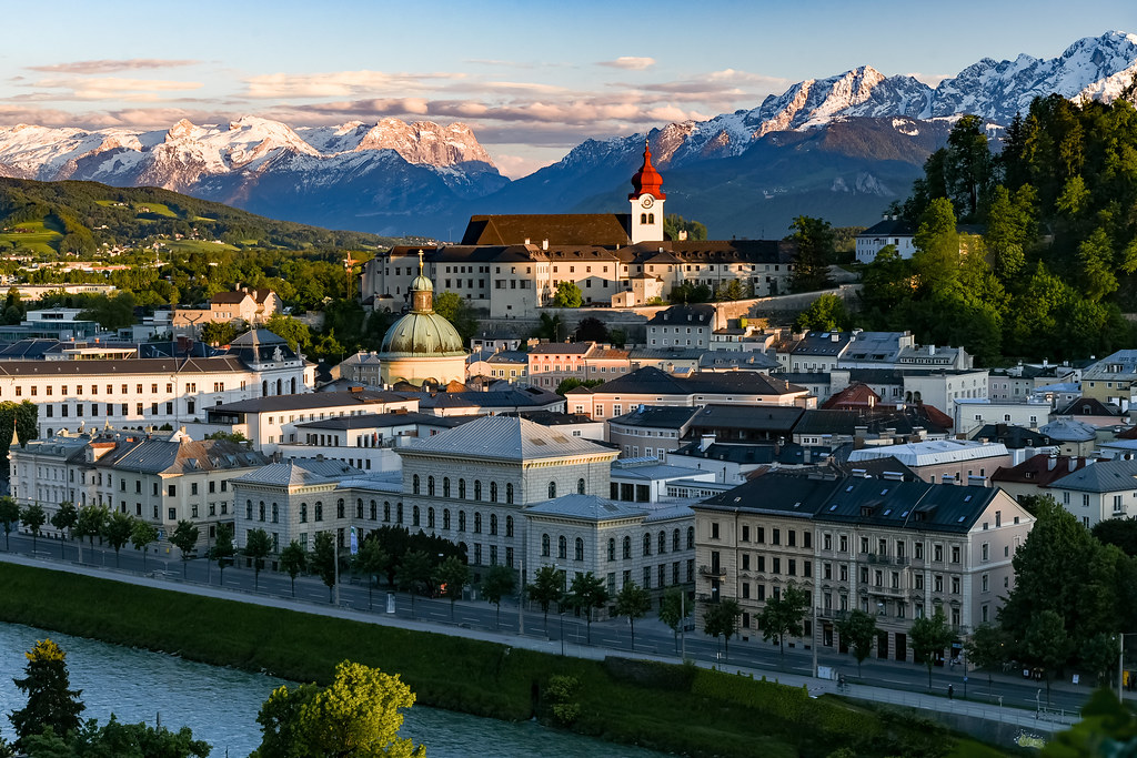
Dorm Selection Process in Salzburg (Austria)
Course: Methods in Spatial Analysis
October 14, 2022
This Story Map presents an example of a distance analysis to find the best-located dorm in Salzburg based on three limiting criteria
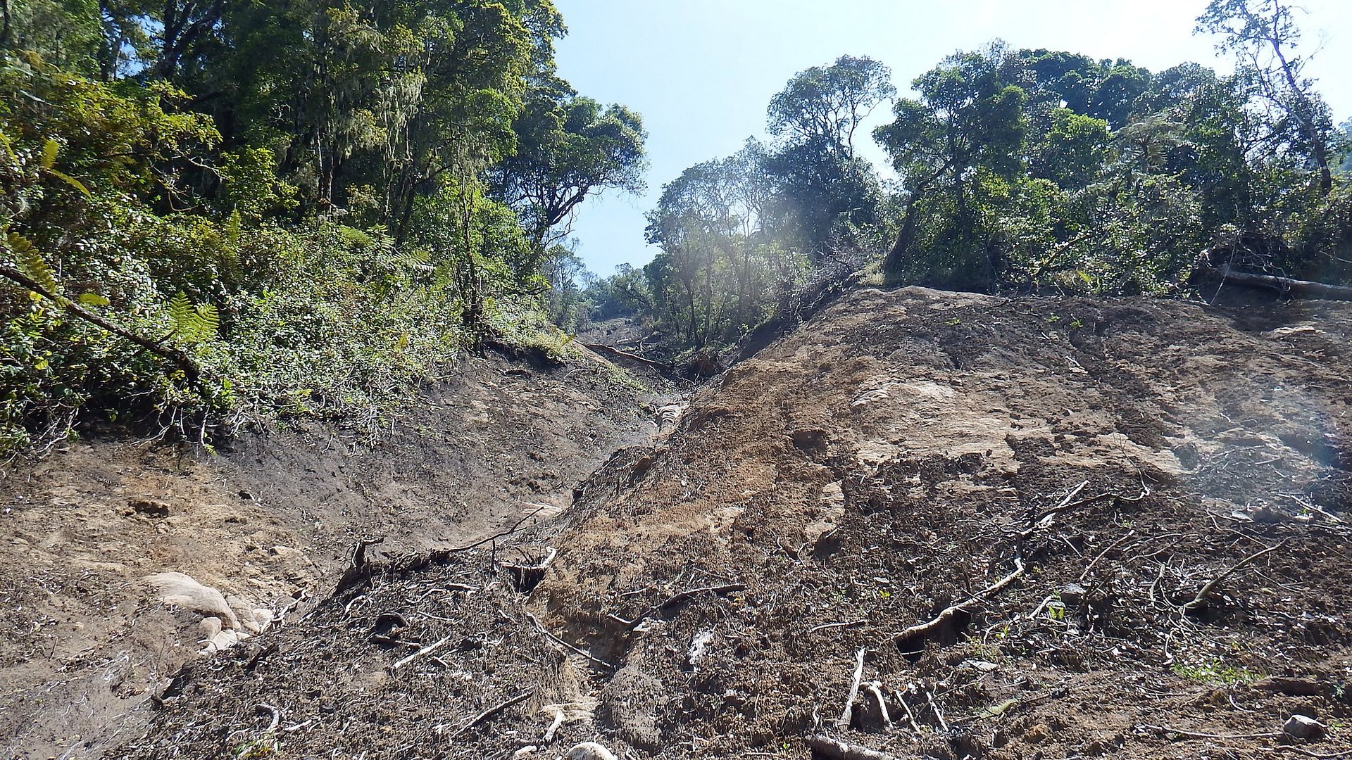
Analysis of the Mass Movements distribution in Colombia
Course: Methods in Spatial Analysis
October 23, 2022
The goal of this Story Map is to use the SIMMA mass movements inventory data of Colombia, in order to understand their distribution by department and occurrance over time
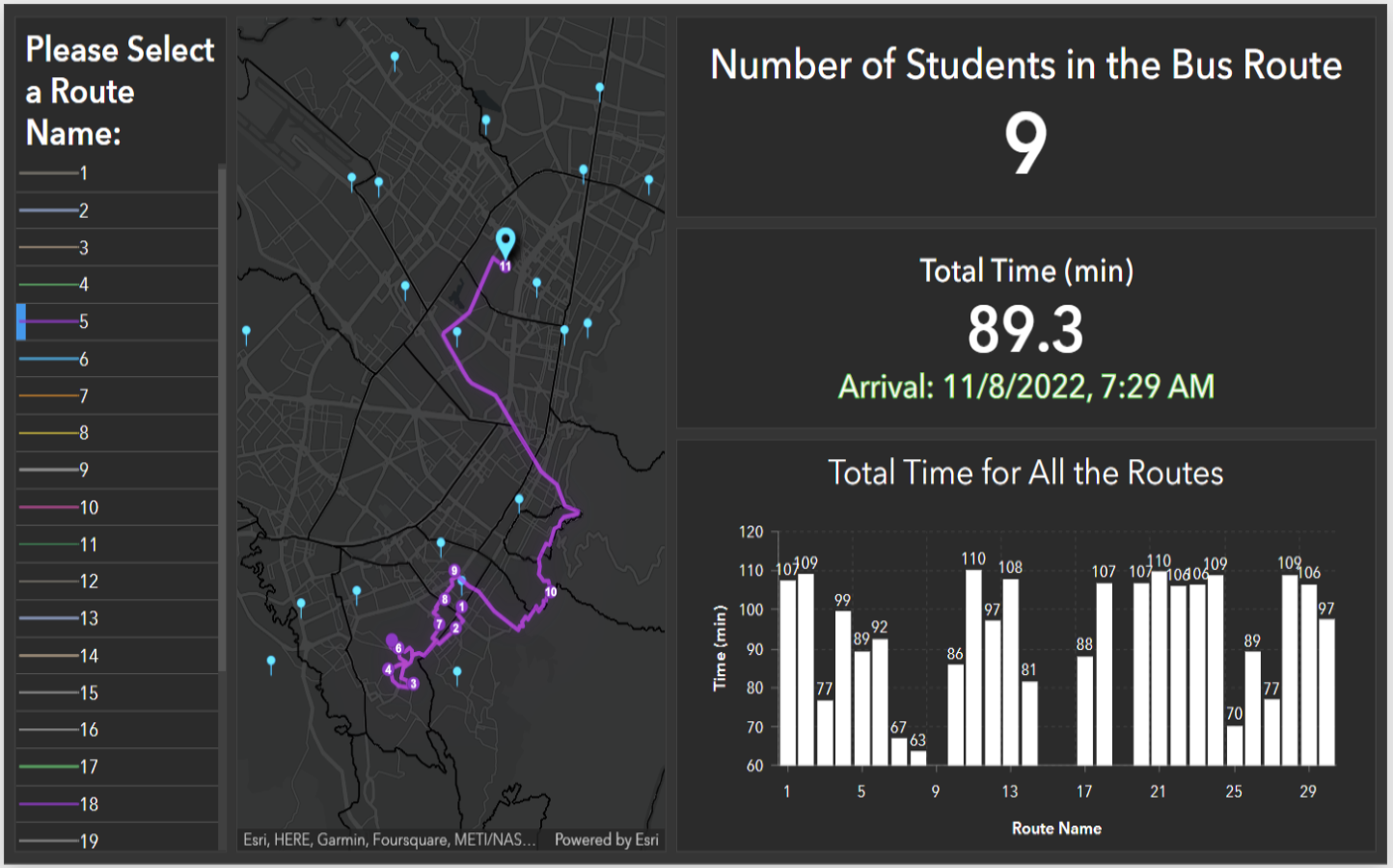
Planning school bus routes for the students of a public school located in Bogotá D.C (Colombia)
Course: Methods in Spatial Analysis
October 30, 2022
The main objective of this Story Maps is to plan school bus routes for the Jorge Eliecer Gaitán school using network analysis and considering the requirements provided by the Bogotá D.C. School Mobility Program.
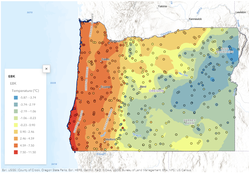
Application of Spatial Interpolation Methods to derive the Mean Monthly Temperature of Oregon State (USA)
Course: Methods in Spatial Analysis
November 21, 2022
This Story Map aims to understand and apply Deterministic and Geostatistical Interpolation Techniques to create prediction surfaces for the mean January temperature in the State of Oregon, USA.
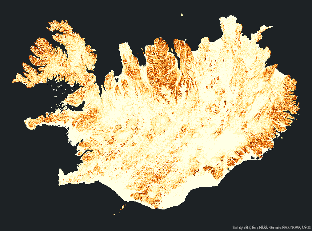
Icelandic Terrain Analysis using ArcGIS Pro Tools
Course: Methods in Spatial Analysis
December 16, 2022
The objective of this Story Maps is to describe Iceland in terms of its topographic parameters and morphometrics.
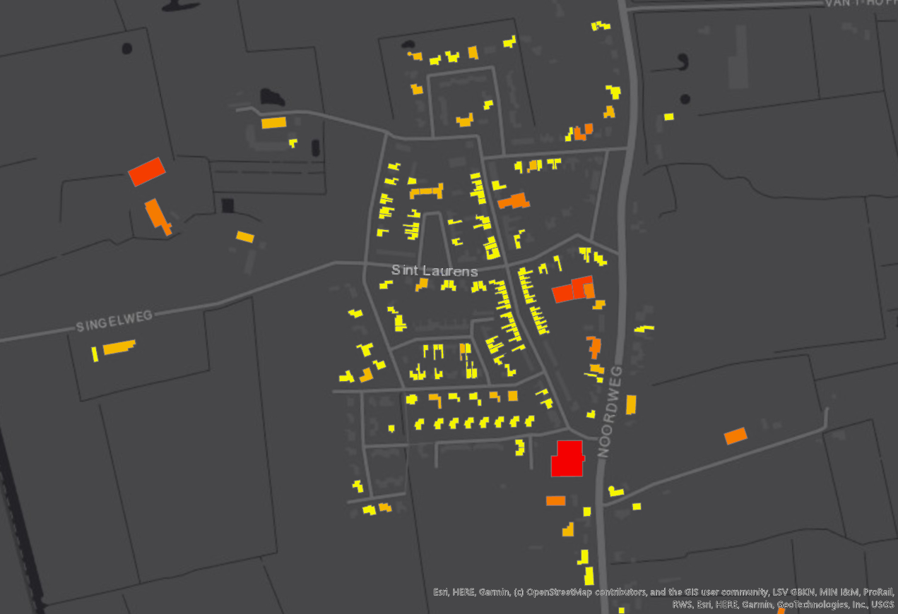
Solar Power Estimation in Sint Laurens Village (Netherlands)
Course: Methods in Spatial Analysis
December 20, 2022
The idea of this Story Maps is to estimate how much electric power each rooftop in Sint Laurens Village (Netherlands) could generate if every suitable building was equipped with solar panels.
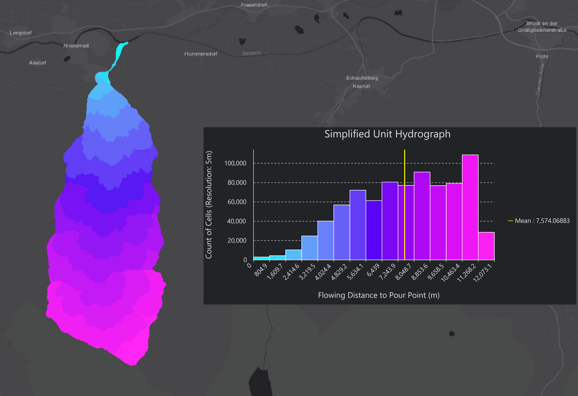
Surface Runoff Analysis in Salzburg (Austria) with the Hydrology Toolset of ArcGIS Pro
Course: Methods in Spatial Analysis
December 29, 2022
In this Story Map, a simplified workflow is built using Model Builder, which outputs the hydrographic and hydrological parameters for a catchment area located in the southwest of the state of Salzburg (Austria).

Wine Quality Classifier utilizing Random Forest and Neuronal Network models
Course: Data Science and Machine Learning
February 19, 2023
The primary objective of this study is to determine whether a given wine is of low, medium, or high quality based on its physicochemical properties. Used dataset: Wine Quality Data Set, obtained from the UCI Machine Learning Repository.